
Mililani Town 🇺🇸
-
Nautical Twilight begins:05:31 amSunrise:06:18 am
-
Sunset:06:35 pmNautical Twilight ends:07:22 pm
-
Moonrise:01:35 am
-
Moonset:03:31 pm
-
Moon over:08:33 am
-
Moon under:09:04 pm
-
Visibility:24%
-
 Waning Crescent
-
Distance to earth:375,173 kmProximity:71.7 %
Moon Phases for Mililani Town
-
good Day
-
minor Time:12:35 am - 02:35 am
-
major Time:07:33 am - 09:33 am
-
minor Time:02:31 pm - 04:31 pm
-
major Time:08:04 pm - 10:04 pm
Tide Clock
Tide Graph
Times
| Tide | Time | Height |
|---|---|---|
| low | 03:51 am | 0.59 ft |
| high | 11:25 am | 2.36 ft |
| low | 07:06 pm | 0.52 ft |
| Date | Major Bite Times | Minor Bite Times | Sun | Moon | Moonphase | Tide Times |
|---|---|---|---|---|---|---|
|
Tue, 16 Sep
|
07:33 am -
09:33 am
08:04 pm -
10:04 pm
|
12:35 am -
02:35 am
02:31 pm -
04:31 pm
|
R: 06:18 am S: 06:35 pm |
R: 01:35 am S: 03:31 pm |
Waning Crescent |
low: 03:51 am
, 0.59 ft
high: 11:25 am
, 2.36 ft
, Coeff: 160
low: 07:06 pm
, 0.52 ft
|
|
Wed, 17 Sep
|
08:26 am -
10:26 am
08:56 pm -
10:56 pm
|
01:37 am -
03:37 am
03:15 pm -
05:15 pm
|
R: 06:19 am S: 06:34 pm |
R: 02:37 am S: 04:15 pm |
Waning Crescent |
high: 12:03 am
, 1.02 ft
, Coeff: 23
low: 05:06 am
, 0.59 ft
high: 12:11 pm
, 2.36 ft
, Coeff: 160
low: 07:31 pm
, 0.46 ft
|
|
Thu, 18 Sep
|
09:16 am -
11:16 am
09:44 pm -
11:44 pm
|
02:37 am -
04:37 am
03:55 pm -
05:55 pm
|
R: 06:19 am S: 06:33 pm |
R: 03:37 am S: 04:55 pm |
Waning Crescent |
high: 12:44 am
, 1.18 ft
, Coeff: 40
low: 06:04 am
, 0.56 ft
high: 12:49 pm
, 2.3 ft
, Coeff: 153
low: 07:52 pm
, 0.46 ft
|
|
Fri, 19 Sep
|
10:01 am -
12:01 pm
10:28 pm -
12:28 am
|
03:32 am -
05:32 am
04:30 pm -
06:30 pm
|
R: 06:19 am S: 06:32 pm |
R: 04:32 am S: 05:30 pm |
New Moon |
high: 01:19 am
, 1.38 ft
, Coeff: 60
low: 06:55 am
, 0.52 ft
high: 01:22 pm
, 2.2 ft
, Coeff: 143
low: 08:12 pm
, 0.43 ft
|
|
Sat, 20 Sep
|
10:44 am -
12:44 pm
11:10 pm -
01:10 am
|
04:26 am -
06:26 am
05:02 pm -
07:02 pm
|
R: 06:19 am S: 06:31 pm |
R: 05:26 am S: 06:02 pm |
New Moon |
high: 01:52 am
, 1.54 ft
, Coeff: 77
low: 07:40 am
, 0.56 ft
high: 01:52 pm
, 2.03 ft
, Coeff: 127
low: 08:30 pm
, 0.43 ft
|
|
Sun, 21 Sep
|
11:25 am -
01:25 pm
10:59 pm -
12:59 am
|
05:17 am -
07:17 am
05:33 pm -
07:33 pm
|
R: 06:20 am S: 06:30 pm |
R: 06:17 am S: 06:33 pm |
New Moon |
high: 02:24 am
, 1.71 ft
, Coeff: 93
low: 08:24 am
, 0.59 ft
high: 02:20 pm
, 1.87 ft
, Coeff: 110
low: 08:49 pm
, 0.43 ft
|
|
Mon, 22 Sep
|
12:06 pm -
02:06 pm
11:41 pm -
01:41 am
|
06:08 am -
08:08 am
06:04 pm -
08:04 pm
|
R: 06:20 am S: 06:29 pm |
R: 07:08 am S: 07:04 pm |
New Moon |
high: 02:56 am
, 1.84 ft
, Coeff: 107
low: 09:07 am
, 0.66 ft
high: 02:47 pm
, 1.71 ft
, Coeff: 93
low: 09:07 pm
, 0.43 ft
|


uploaded by: Heathen Monk

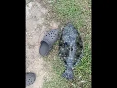
uploaded by: Flounder pounder

uploaded by: Stephen Spencer

uploaded by: Jon “Kuse”

uploaded by: Elzen Harris

uploaded by: RAMason69

uploaded by: Steven Butcheck

uploaded by: Joey Piercefield

uploaded by: Hoza

uploaded by: John Matthews
Mililani
Best Fishing Spots in the greater Mililani Town area
Wharf's or Jetties are good places to wet a line and meet other fishermen. They often produce a fresh feed of fish and are also great to catch bait fish. As they are often well lit, they also provide a good opportunity for night fishing. There are 1 wharf(s) in this area.
Hickman Field Wharf - 14km
Beaches and Bays are ideal places for land-based fishing. If the beach is shallow and the water is clear then twilight times are usually the best times, especially when they coincide with a major or minor fishing time. Often the points on either side of a beach are the best spots. Or if the beach is large then look for irregularities in the breaking waves, indicating sandbanks and holes. We found 20 beaches and bays in this area.
‘Aiea Bay - 11km , Kai Beach - 11km , Kupaka - 15km , Iroquois Beach - 15km , Hickam Harbor Beach - 16km , Fort Kamehameha Beach - 16km , Ula‘ula - 16km , One‘ula Beach - 16km , Ewa Plantation Beach - 16km , Ke‘ehi Lagoon Beach - 17km , Zablan Beach - 17km , Manners Beach - 17km , Waipahu Beach - 17km , Nimitz Officers Beach - 17km , Nimitz Beach - 18km , Lanikuhonua Beach - 18km , Ka‘ula Bay - 18km , Kahana Bay - 19km , Kanenelu Beach - 19km , Kaiaka Bay - 19km
Harbours and Marinas can often times be productive fishing spots for land based fishing as their sheltered environment attracts a wide variety of bait fish. Similar to river mouths, harbour entrances are also great places to fish as lots of fish will move in and out with the rising and falling tides. There are 5 main harbours in this area.
Ke‘ehi Boat Harbor - 18km, Barbers Point Harbor - 18km, Berth Number 40A - 19km, Berth Number 39B - 19km, Berth Number 39A - 19km
We found a total of 100 potential fishing spots nearby Mililani Town. Below you can find them organized on a map. Points, Headlands, Reefs, Islands, Channels, etc can all be productive fishing spots. As these are user submitted spots, there might be some errors in the exact location. You also need to cross check local fishing regulations. Some of the spots might be in or around marine reserves or other locations that cannot be fished. If you click on a location marker it will bring up some details and a quick link to google search, satellite maps and fishing times. Tip: Click/Tap on a new area to load more fishing spots.
Waikakalaua Ditch - 2km , Waiāhole Ditch - 3km , Waiawa Ditch - 3km , O‘ahu - 4km , Oahu Island - 4km , Wilson Bridge - 6km , Old Ahern Ditch - 7km , Ko‘olau Ditch - 7km , Canon Dam - 8km , Middle Loch - 8km , East Loch - 9km , Pearl City Peninsula - 9km , West Loch - 9km , Loch Point - 9km , McGrew Point - 10km , Mokunui - 10km , Ford Island - 10km , Beckoning Point - 10km , Kipapa - 10km , Kapapapuhi Point - 10km , Laulaunui Island - 10km , Nichols Point - 10km , Hanaloa Point - 10km , Intrepid Point - 10km , Waipi‘o Peninsula - 10km , McCandless Ditch - 11km , ‘Aiea Bay - 11km , Mokuiki - 11km , Kai Beach - 11km , Pearl Harbor - 11km , Nevada Point - 11km , Helemano Reservoir Ditch - 11km , Powder Point - 11km , Baltimore Point - 11km , Keka‘a Point - 11km , Quarry Loch - 12km , Merry Loch - 12km , Magazine Loch - 12km , Merry Point - 12km , Southeast Loch - 12km , Hospital Point - 12km , Waipi‘o Point - 12km , Iroquois Point - 13km , Okiokiolepe Pond - 13km , Salt Lake - 14km , Bishop Point - 14km , Hickman Field Wharf - 14km , Wahiawā Reservoir Ditch - 14km , Hammer Point - 14km , Holokahiki Point - 15km , Kemoo Ditch Tunnel - 15km , Keahi Point - 15km , ‘Ōpae‘ula Ditch - 15km , Kupaka - 15km , Iroquois Beach - 15km , Hickam Harbor - 16km , Hickam Harbor Beach - 16km , Fort Kamehameha Beach - 16km , Ula‘ula - 16km , One‘ula Beach - 16km , Ewa Plantation Beach - 16km , Ke‘ehi Lagoon Beach - 17km , Onini Island (historical) - 17km , Mōli‘i Pond - 17km , Ahua Point - 17km , Zablan Beach - 17km , Manners Beach - 17km , Waipahu Beach - 17km , Kahe Point - 17km , Kumumau Point - 17km , Ito Ditch - 17km , Wailau Point - 17km , Kahalu‘u Pond - 17km , Kamananui Ditch - 17km , Nimitz Officers Beach - 17km , Keku Point - 17km , Huilua Pond - 18km , Kaluapuleho Point - 18km , Keaniani Point - 18km , Kapa‘ele‘ele Point - 18km , Ke‘ehi Boat Harbor - 18km , Ke‘ehi Lagoon - 18km , Kualoa Point - 18km , Nimitz Beach - 18km , Anianikū Cove - 18km , Milo Cove - 18km , Kalaeaalakihi - 18km , Pokole Point - 18km , Lanikuhonua Beach - 18km , Ka‘ula Bay - 18km , Barbers Point Harbor - 18km , Kahana Bay - 19km , Berth Number 40A - 19km , Berth Number 39B - 19km , Māhie Point - 19km , Makahonu Point - 19km , Berth Number 39A - 19km , Kanenelu Beach - 19km , Kaiaka Bay - 19km , Ka‘a‘awa Point - 19km
Comments